The European Greenways Association (EGWA) was established in 1998 in Namur (Belgium) with the aim of promoting the creation and development of greenways across Europe. Today, it brings together nearly 50 organisations from 17 European countries involved in greenway development.
With gentle slopes, restored tunnels, bridges, and viaducts, and renovated station buildings now serving as cafés, accommodations, visitor centers, and museums, the Greenways offer environmentally friendly travel and the opportunity to explore the cultural, historical, and natural richness of Spain and Portugal on foot or by bike.Here you can have a look at the map of the Greenways in the Iberian Peninsula.
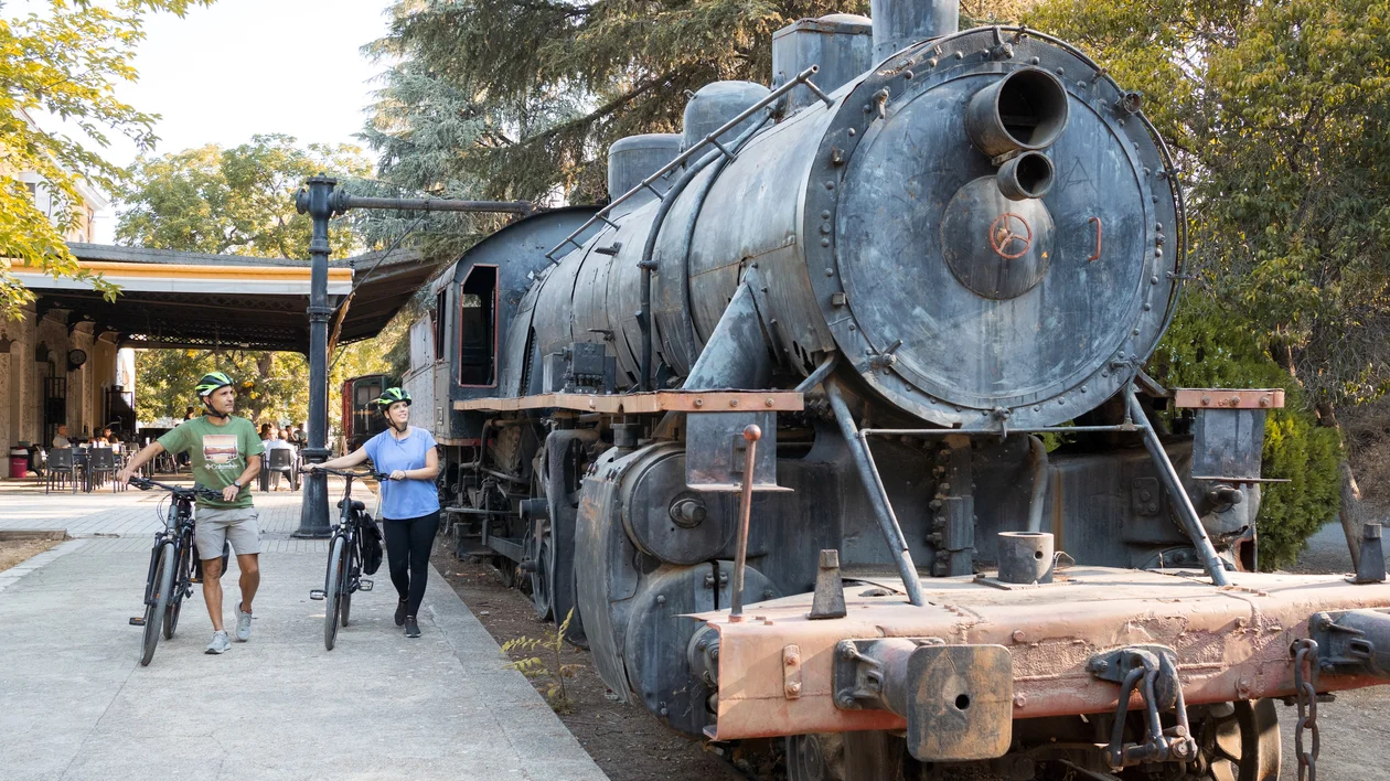
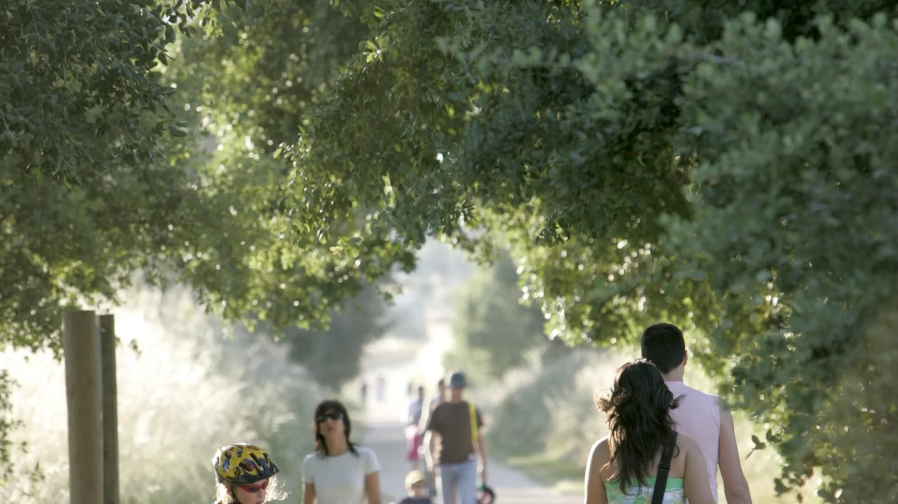
An abandoned railway lines transformed into accessible routes for walking, cycling, and ecotourism. Since 1993, thousands of kilometers of former rail corridors have been converted into safe, traffic-free paths that connect nature, cultural heritage, and local communities. Today, Spain has around 3,600 kilometers of Greenways across 143 routes, with more than 150 restored stations. The program, managed by the Spanish Railways Foundation, has received numerous international awards for sustainability, accessibility, heritage conservation, and tourism innovation.
Vies Verdes de Girona
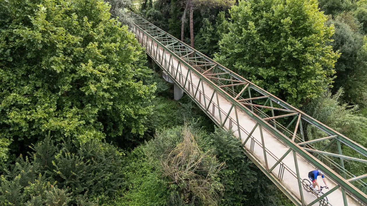
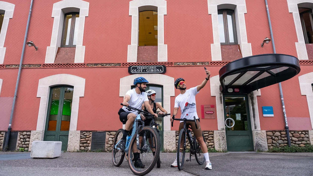
Among the earliest and most iconic railway-to-trail conversions in Spain is the 160 -kilometer network of Greenways Vies Verdes de Girona, in Catalonia, which connects the Pyrenees to the Costa Brava. Its origins lie in the historic carrilets (narrow-gauge railways). In the late 19th century, private industrial entrepreneurs — supported by engineers and local communities — developed these so-called “cheap trains” to improve the transport of goods and access to ports, marking an important step in regional industrial development. Today, these former railway lines, once vital links between communities, have been beautifully restored and transformed into Greenways.
One of the first major sections to be redeveloped was the Ruta del Carrilet I, running from Olot — a town known for its Baroque, Neoclassical, and Catalan Modernist architecture — to the outstanding medieval city of Girona. This approximately 55-kilometer greenway features a gentle downhill profile and crosses three regions, passing through river valleys, volcanic landscapes, and charming towns. From Girona, the network continues along the Ruta del Carrilet II, which connects the city with the historic coastal town of Sant Feliu de Guíxols. This 41.9-kilometer greenway offers a peaceful journey through a varied patchwork landscape of farmland and forest, with wide views on clear days stretching from the eastern Pyrenees to the Montseny and nearby mountain ranges. The Girona Greenways Consortium and public transport operator TEISA have launched a Bici Bus service along Girona’s popular greenways. Operating on weekends and holidays, the buses are equipped with trailers for transporting bicycles.
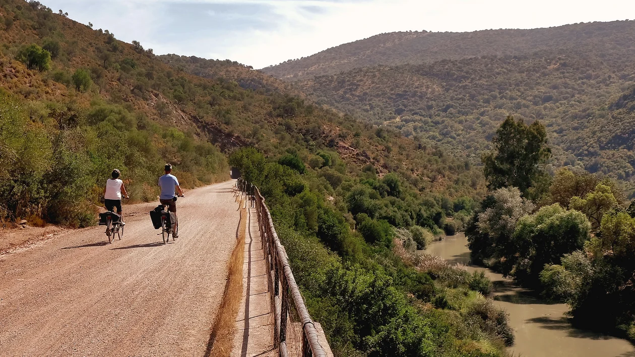
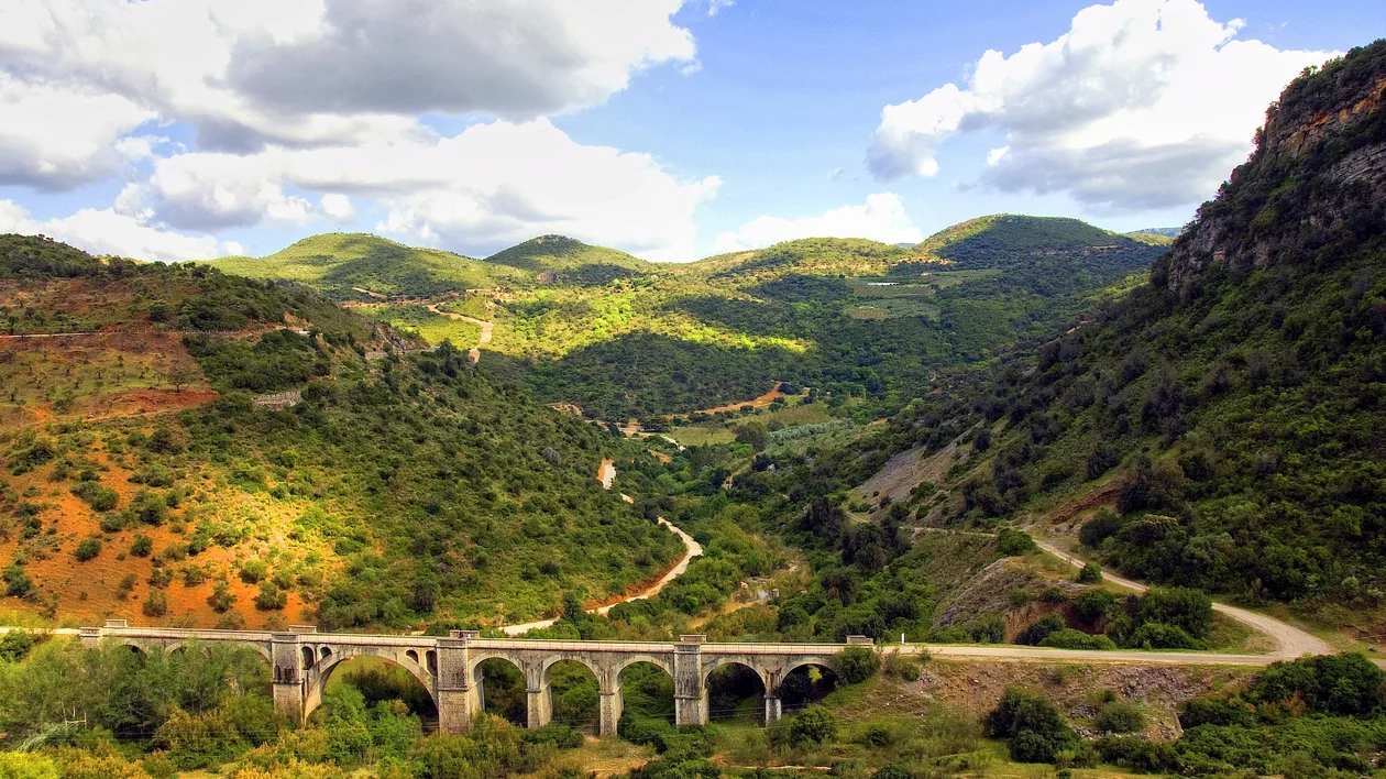
Andalucía has a network of 25 Greenways totaling over 800 kilometers, showcasing diverse landscapes and providing a direct connection with nature, history, and local heritage. The longest route is the Vía Verde del Aceite, a 128-kilometer greenway between Córdoba and Jaén, which follows the former Tren del Aceite (Olive Oil Train). The route passes through extensive olive groves, rolling countryside, and the Sierras Subbéticas, as well as numerous towns along the way. It features impressive 19th-century engineering works, including 13 splendid metal railway viaducts from the Eiffel school, three tunnels, and 12 old railway stations. Along the greenway, you can also find local products such as wine and olive oil, labeled under the Vía Verde del Aceite brand.
Another famous Andalusian Greenway is the Vía Verde de la Sierra, a 36.5-kilometer route between Cádiz and Seville. This greenway showcases 30 railway tunnels, including the 990-meter Castillo tunnel, many of which are illuminated, while others offer a darker, more atmospheric experience where wildlife such as bats can be observed. The Vía Verde de la Sierra follows a never-completed 1926 railway project and showcases over 300 engineering structures along its length, including four remarkable stone viaducts built in the 1930s. A visit to the Interpretation Center of the Vía Verde de la Sierra, located near Olvera Station, is highly recommended. This interactive visitor center explains the greenway’s history, landscapes, and biodiversity through exhibitions and multimedia displays. Another key attraction is the Centro de Interpretación y Observatorio Ornitológico del Peñón de Zaframagón, a visitor center equipped with live video monitoring that allows real-time observation of a large colony of griffon vultures nesting in the surrounding cliffs, along with educational exhibits about the area’s wildlife and natural environment.
Beautiful examples of industrial heritage interpretation, with ten Greenways and approximately 180 kilometers of disused railway lines transformed into scenic, accessible trails for walking and cycling.
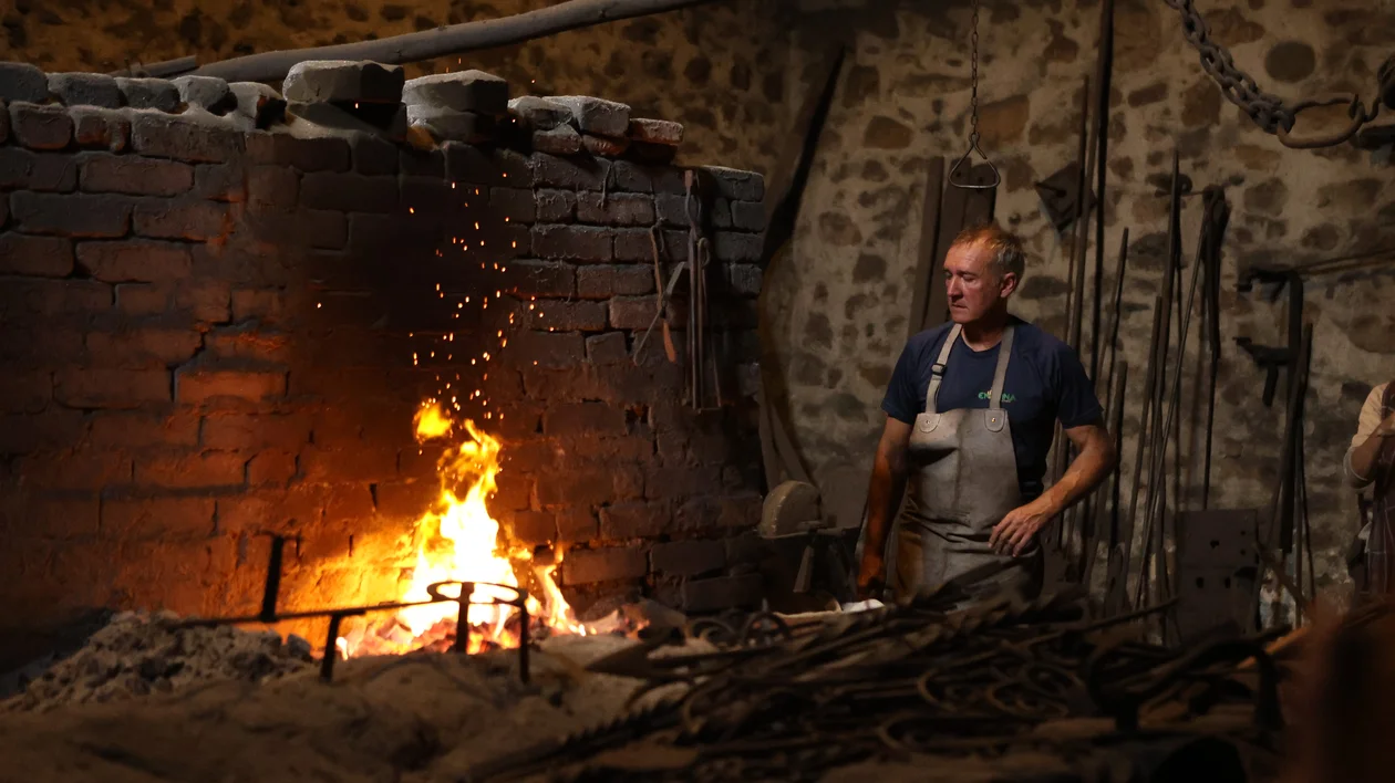
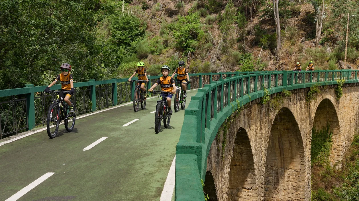
The Montes de Hierro Greenway (Iron Mountains Greenway, Burdinmendi in Basque) won the European Greenways Award in 2025. It is a living testimony to the industrial mining heritage of Bizkaia (Basque Country, Spain), an economic engine of the Industrial Revolution, transformed into a safe route for sustainable mobility that combines rich heritage with natural beauty. This 39-kilometer route links inland valleys with the coast, passing through forests, rural landscapes, tunnels, and industrial remains related to the region’s iron mining history. The Greenway is complemented by an additional 20-kilometer connection to Bilbao, a European capital of art and a vibrant cultural destination in northern Spain. One of the iconic attractions along the route is the Museo de la Minería del País Vasco (Mining Museum of the Basque Country) in Abanto-Zierbena, which preserves the region’s mining heritage. In its surroundings lies the large Concha II mine, once the largest iron mine in Europe, with 50 kilometers of tunnels running beneath the area.
Make a point of taking the Plazaola Greenway in Navarra, a former narrow-gauge railway converted into a scenic 78-kilometer route for walking and cycling that runs through lush forests, mountain landscapes, and valleys between Pamplona and the Basque Country, forming a peaceful corridor with strong natural and industrial heritage value. It is especially known for its 53 tunnels — including the 2.7-kilometer Uitzi tunnel, the longest greenway tunnel in Europe — and its well-preserved railway infrastructure, such as bridges and stations, offering a continuous journey through the Larraun and Leitzaran valleys, rich in both natural and cultural heritage.
Another famous Greenway is the Vasco-Navarro Railway Greenway, a 125.5-kilometer route between Estella-Lizarra and Bergara/Oñati, which passes through Vitoria-Gasteiz, the vibrant capital of the Basque Country, known as one of Europe’s greenest cities. Also known as El Trenico, this route crosses the mountains and rural plains of Álava. The route presents rich cultural and railway heritage, including the Arquijas Viaduct and the 1.4-kilometer-long Acedo Tunnel. Be sure to visit the Vasco Navarro Railway Greenway Interpretation Center in the medieval town of Antoñana, which explores the history of this former railway.
A peaceful, scenic, heritage-rich trails that transform former railway lines into long-distance routes for slow and sustainable travel across the country. They are exemplary initiatives that demonstrate how disused infrastructure can be repurposed for sustainable mobility and ecotourism while preserving railway heritage, including historic stations decorated with beautiful azulejos (traditional painted ceramic tiles), as well as bridges, tunnels, and rural landscapes. The network comprises 15 greenways across 20 former railway lines, totaling 518 kilometers currently in operation, managed by the National Ecopistas Program of IP Património.
The Northern part
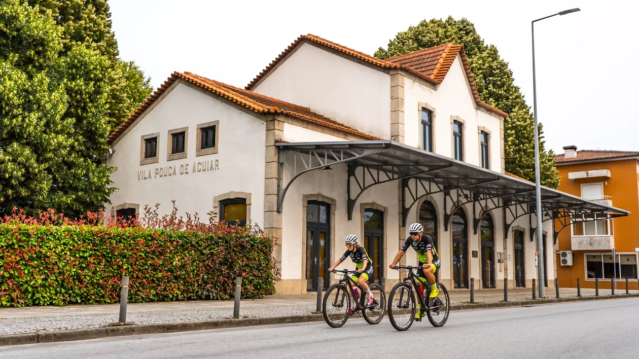
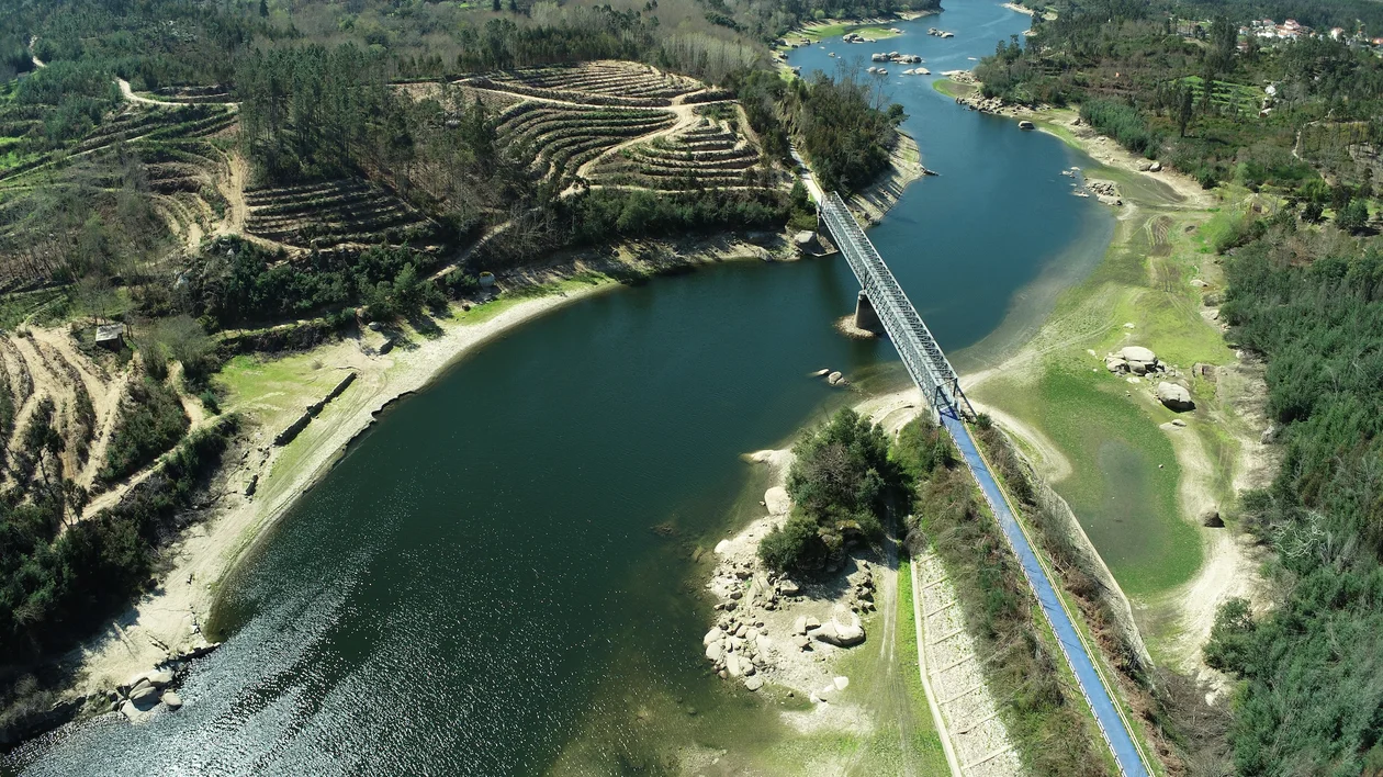
The International Tâmega and Corgo Greenway is definitely worth exploring, a 55-kilometer ecopista created along the former railway line completed in 1921 to connect Vila Real to Régua. Originally, the railway provided access to the thermal spas of Vidago and Pedras Salgadas. Today, the route also crosses the original path of the Portuguese Interior Camino de Santiago. Halfway along the route, in Parada de Aguiar, pilgrims can find the Albergue de Santiago. Along the greenway, ecotourists can enjoy magnificent railway heritage, renovated old train stations in Vila Real and Vila Pouca de Aguiar, and peaceful rural landscapes — by bicycle, on foot, or on horseback, through avenues of oak and chestnut trees against a backdrop of vineyards and fruit trees. In addition to its railway heritage, the route highlights the towns of Pedras Salgadas, Vidago, and Chaves, all famous for their thermal waters. The heart of the greenway is the Vila Pouca de Aguiar Welcome Center, located in Pedras Salgadas in a beautifully renovated former railway station. The municipality of Vila Pouca de Aguiar is also renowned for its cuisine and local products, including Batata do Alvão (IGP) (a potato), Cabrito Bravio (DOP) ( a suckling goat of the Bravio breed), Castanha da Padrela (DOP) (a chestnut), Maronesa beef (DOP), and the famous onions, wild mushrooms, and honey. In Chaves the ecopista extends north and connects to Verín in Spain.
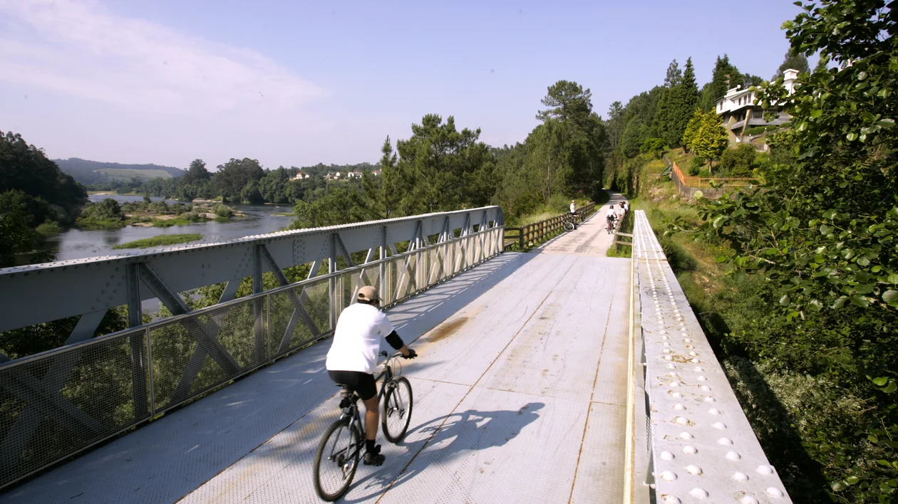
Another stunning example is the Ecopista do Minho, which follows part of the former Minho railway line connecting the historic towns of Valença and Monção. Valença is home to the impressive 17th-century star-shaped fortress la Fortaleza de Valença, while Monção is known for its rich history as a fortified border town with Spain, as the birthplace of Alvarinho wine, as well as its thermal spas. The Ecopista runs along the Minho River valley, offering approximately 15 kilometers of accessible trail through riverside landscapes, vineyards, and rural areas characteristic of the Minho region.
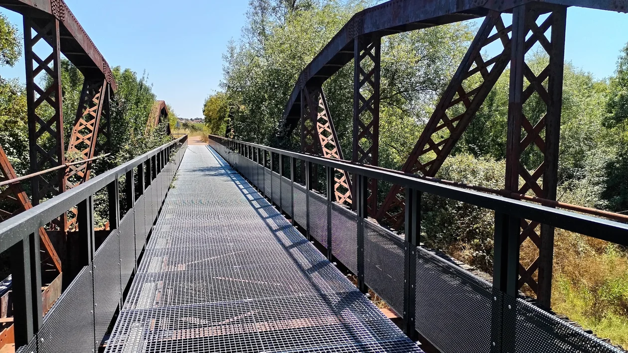
Central Portugal is known for the Ecopista do Vouga, about 76 kilometers long, which follows a former railway line through forests, valleys, small towns, and historic railway structures, offering a continuous and accessible route for cyclists and walkers. This greenway follows the route of the former Viseu branch line between Sernada do Vouga and Viseu in the Vouga River valley, crossing the magnificent landscapes of the municipalities of Viseu, São Pedro do Sul, Vouzela, and Oliveira de Frades. Along the route are numerous engineering works to cross, such as tunnels and the historic Vouzela Bridge and Poço de Santiago Bridge. The latter is a monumental structure considered to be one of the highest stone masonry bridges in Portugal, at 28.5 meters in height and consisting of eleven perfectly rounded arches supporting a 165-meter deck. Crossing these bridges is a breathtaking experience. Near the former Paradela Station, a well-preserved site, stands the Vouga Pasta Factory, built in an industrial-evolution-era style.
Next, the Ecopista do Dão, is a 49-kilometer greenway running between the cities of Viseu and Santa Comba Dão that follows the former Dão railway line and passes through a diverse landscape of forests, vineyards, rivers, and rural villages. The route is one of Portugal’s most popular cycling and walking paths, offering scenic views, tunnels, bridges, and rest areas along the way.
You must visit the region of Alentejo Central, characterized by rolling plains, cork oak forests, vineyards, and olive groves. It is a patchwork of rustic whitewashed villages and authentic rural life, traditional foods, and the characteristic landscape of the Grande Rota do Montado. The montado is a traditional, human-oriented ecosystem recognized as a "biodiversity sanctuary" that integrates crops, livestock grazing, and forestry featuring low-density, savannah-like evergreen oak forests. Évora, the regional capital, a 2027 European Capital of Culture, and a UNESCO World Heritage Site, features a Roman temple known as the Templo de Diana. Alentejo Central hosts three remarkable greenways, which are part of the Grande Rota do Montado network and are designed for cycling and walking.
Ecopista de Reguengos is an almost 42-kilometer greenway route running from UNESCO-listed Évora to Reguengos de Monsaraz, and is rich in cultural heritage. You will pass through olive orchards, picturesque vineyards, cork oak forests, and riverside vegetation. Wildlife commonly seen along the trail includes swallows, owls, robins, partridges, hares, and rabbits.
A further beautiful greenway in the region is Ecopista de Mora, a 31-kilometer route running from Évora to Vale de Paio, developed along the former Mora railway branch. The route combines cultural heritage with nature tourism, offering visitors the chance to explore the traditional village of Arraiolos — famous for its handmade carpets — and the rural landscape of the Alentejo plains.
Last but not least in this region is the Ecopista do Montado, a greenway that follows a former railway corridor in the municipality of Montemor-o-Novo. The 13-kilometer route runs through the characteristic montado landscape, offering rural scenery, local biodiversity, and elements of the region’s cultural heritage, making it part of a broader initiative to promote sustainable mobility and nature-based tourism in Alentejo.
Be sure to visit the Spanish Vías Verdes and Portuguese ecopistas, where southern charm meets natural beauty and cultural richness!